


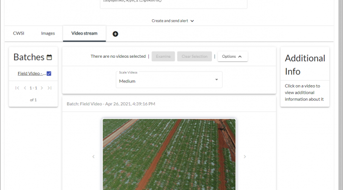
The GreenWaterDrone Aerial Surveillance Application uses the content collected by the aerial platform’s (UAV) cameras, in order to make the critical situations probably recognized by the foremen of a field or a geographical area in general.
The content recorded during the flight is delivered after the return of the aerial platform, gets transferred to the system by a responsible data operator and connects to the individual fields. In case of a photographic material with appropriate geo-identification information, it shall be automatically assigned by the system to the boundaries of each field. If the material is not marked or it is a video, the connection is made manually by the flight data operator, in order to ensure the confidentiality of the data in general and especially the protection of personal data.
Then, the audiovisual material of the surveillance appears with timestamp to each field with which has been automatically or manually connected, while the responsible authorized user of the field is able to watch it through the application.
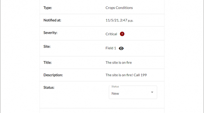
In addition to the availability of the material, the flight attendant can create a notification to specific fields of various levels, indicating the relevant visual surveillance material, in case he notices a special condition.
Potentially, data processing channel can automatically generate alerts proportional to CWSI notifications. However, this is out of GreenWaterDrone's interest.
The interface of the Air Surveillance Application is embedded into the interface of the Irrigation Management Application, giving the user a unified environment to watch the field that he manages or monitors.