

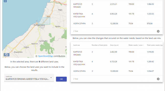
The Irrigation Scaling Application is a pilot system aimed at the user who wishes to understand the irrigation need of the crops of an area and the impact of crops on a large scale.
The application is based on previous years’ real geospatial data and assessments of the irrigation needs that crops have in each area. The analyst or strategic user can select a geographical area of interest and visualize the crops found in it, as well as their irrigation needs.
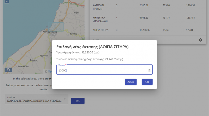
Then, the crop mix can be modified, changing the use of land, thus creating hypothetical scenarios of strategic planning so that the system can estimate the new created hypothetical irrigation needs.
All these can be done through a modern and easy-to-use web interface, which starts by selecting the area of interest on the map and gradually helps the user to import data in order to create scenarios that wants to analyze, while it is supported by services providing geospatial data.